SeaLevelRise.se - Earth - 3D Coasts -
Overview
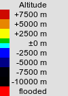
3D scene (X3D/X3DOM) of Earth with selectable maps of
height and population, and with links to interactive 3D scenes of
coastal areas (1186 x 667 km = 11 x 6°) with variable terrain attenuation,
sea level and cities, created from open geodata. (Svenska)
topgraphy: GEBCO_2014 Grid v20150318 (CC BY 4.0)
population: SEDAC GPW v4.0 2015 UN (CC BY 4.0)
| Scene markers: | show |
| Map: | |
| Navigation Mode: | |
| Debug Display: | Stats Log |
scene
country
0°N 0°E